Caltrans wants to add bike lanes to PCH through Long Beach. Now's your chance to weigh in
The project, which would take the seven-lane highway down to five, is meant to make the street safer as traffic-related deaths are set to hit a record high this year.

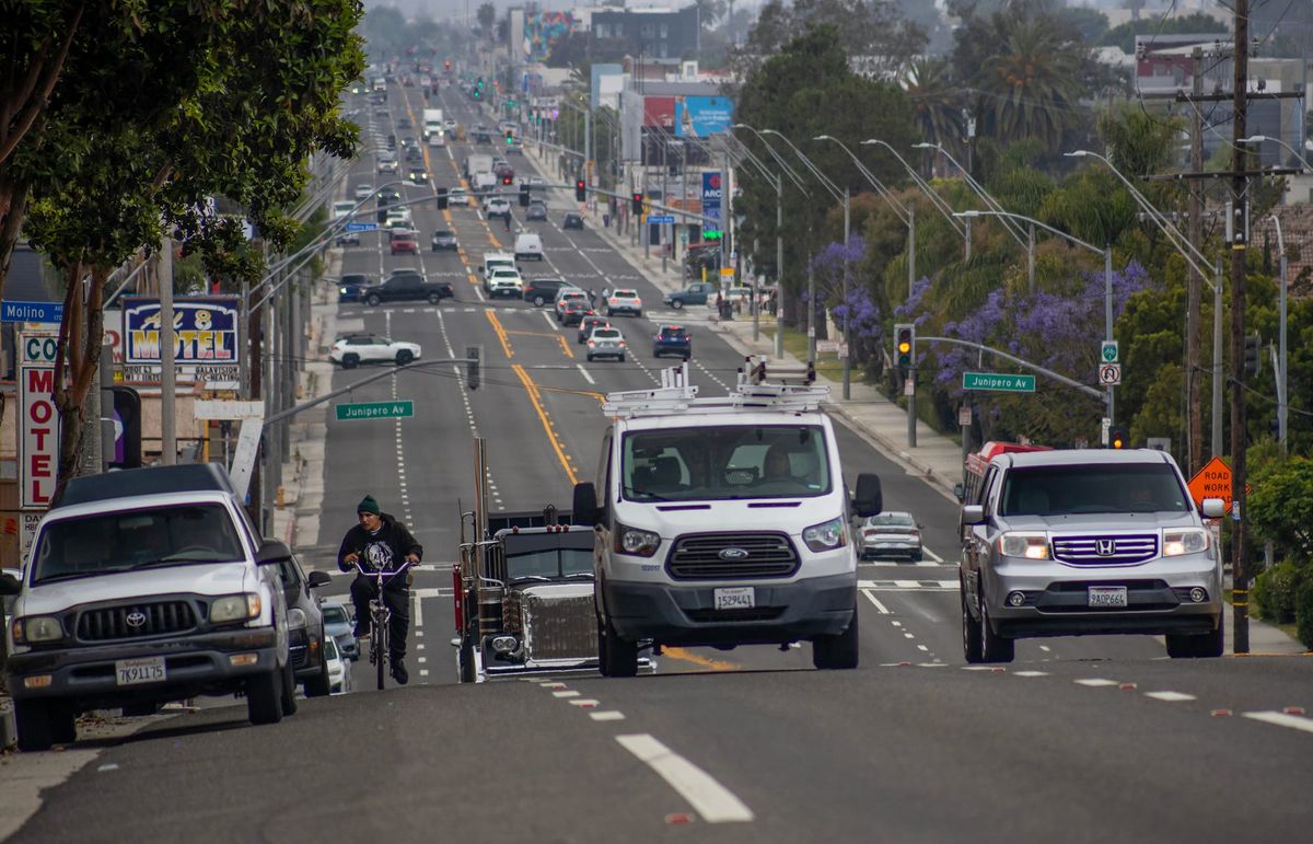
Pacific Coast Highway is famous for being a scenic coastal drive for visitors to much of the Golden State. But not in Long Beach, where it cuts through town as a busy — and deadly — thoroughfare. While the view cannot be upgraded to coastal, Caltrans, in partnership with the city of Long Beach, is looking to address the safety issues.
The state agency has two proposals on the table to reduce the seven-lane street to five to make way for protected bike lanes on either side of PCH. While the highway is owned by the state, PCH was identified by the city in its 2016 Bicycle Master Plan and subsequent 2020 Safe Streets Action Plan as needing improvements, including bike lanes.
During an Oct. 15 virtual briefing with City Council and other stakeholders, Benjamin Medina, a transportation planner for Caltrans, outlined the two proposals for bikeways running from the traffic circle to the Los Angeles River:
Alternative 1
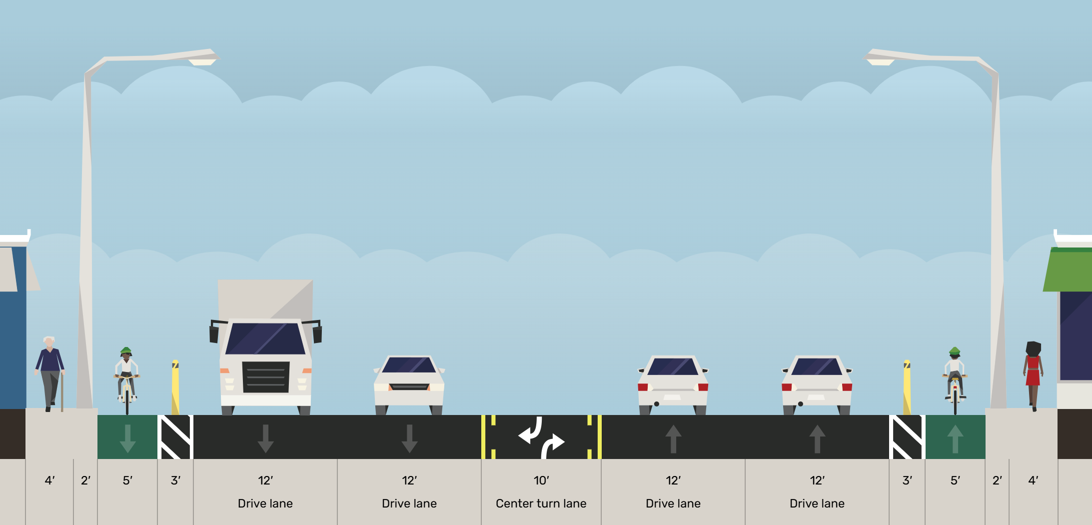
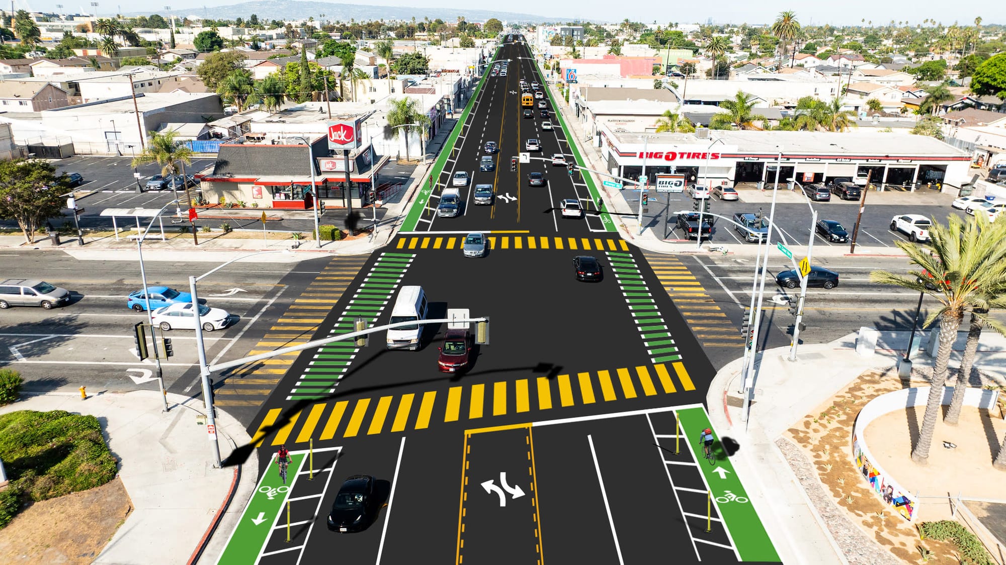
A street level bike lane separated from traffic by a three-foot-wide median, including painted lines as well as bollards or other dividers, renderings show. The bike lanes would take the place of the two outer lanes, leaving two driving lanes in each direction as well as a middle lane for turning at intersections.
Currently, the outer lane in either direction serves as parking except during rush hour when it is opened up to driving traffic.
The project would cost an estimated $9 million, according to Medina, who added that it would be completed in summer 2030 (barring weather delays) after about 12 to 15 months of construction. This version of the project is already fully funded by Caltrans, Medina said.
Alternative 2
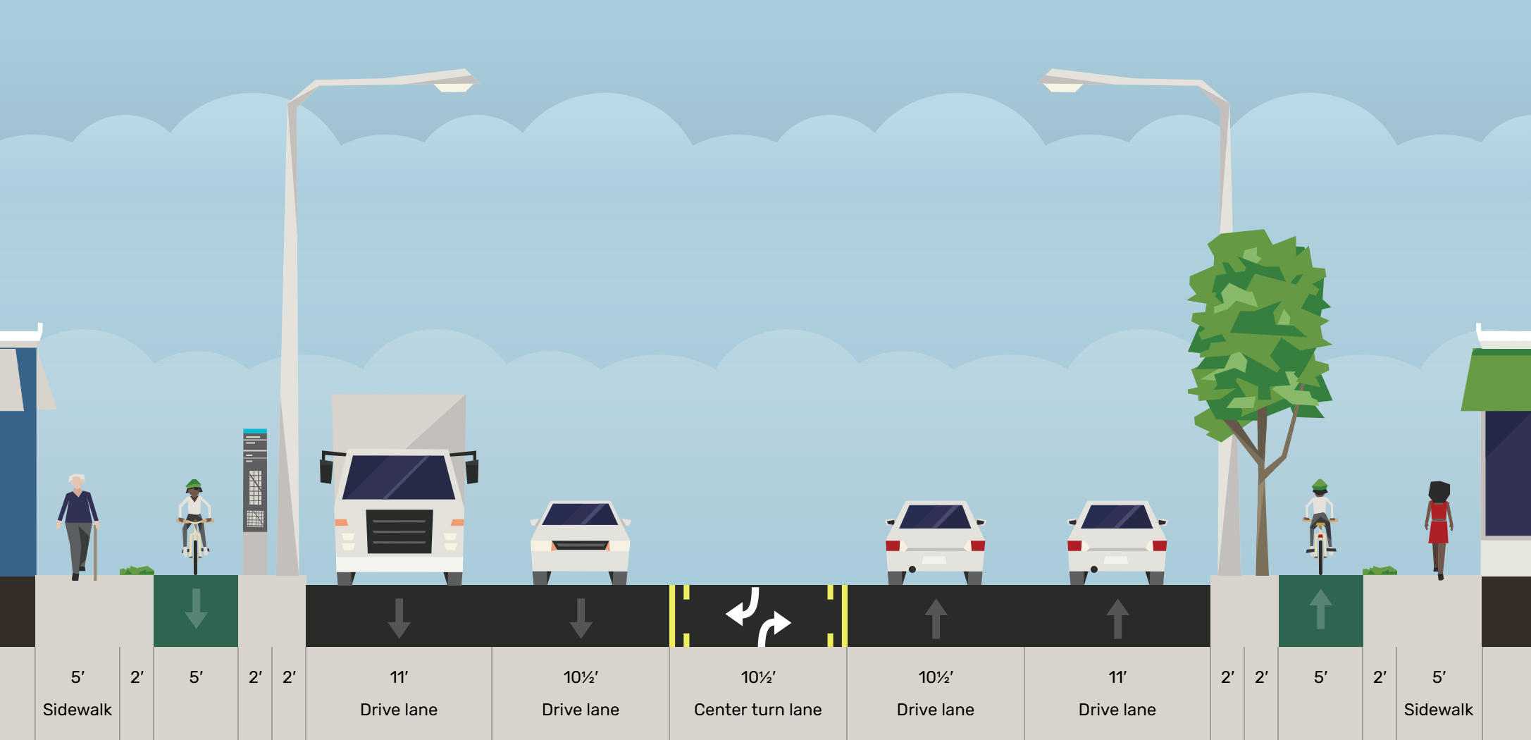

A sidewalk-level bike path, which would be separated from traffic by four feet of elevated sidewalk, including light poles and other common street-side objects. Like Alternative 1, the project would remove one driving lane in either direction, leaving a total of four driving lanes and the center turn lane.
This version of the project is vastly more extensive, Medina said, and includes moving sewer lines, power lines, streetlights and stormwater drainage as well as adding landscaping, lighting and signage. As a result, the price tag would be $104 million, according to Medina, who added that Caltrans would “have to coordinate with local and regional partners to identify … funds in which we can apply for.”
Alternative 2 would require three years of construction with an estimated completion time of summer 2035, Medina said.
A public workshop for the project is scheduled for Wednesday, Oct. 29 from 6 to 7:30 p.m. in Room QQ112 at Long Beach City College’s Trades, Technology, and Community Learning Campus (formerly PCC) located at 1305 E. Pacific Coast Highway. Click here to register.
Caltrans also has an active online survey (here) that is open until Wednesday, Nov. 26. Comments can also be left by calling 855-925-2801, project code: 11835, or via email at 99335@publicinput.com.
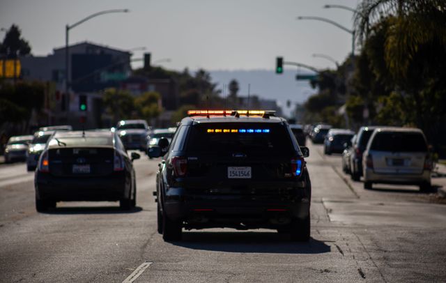
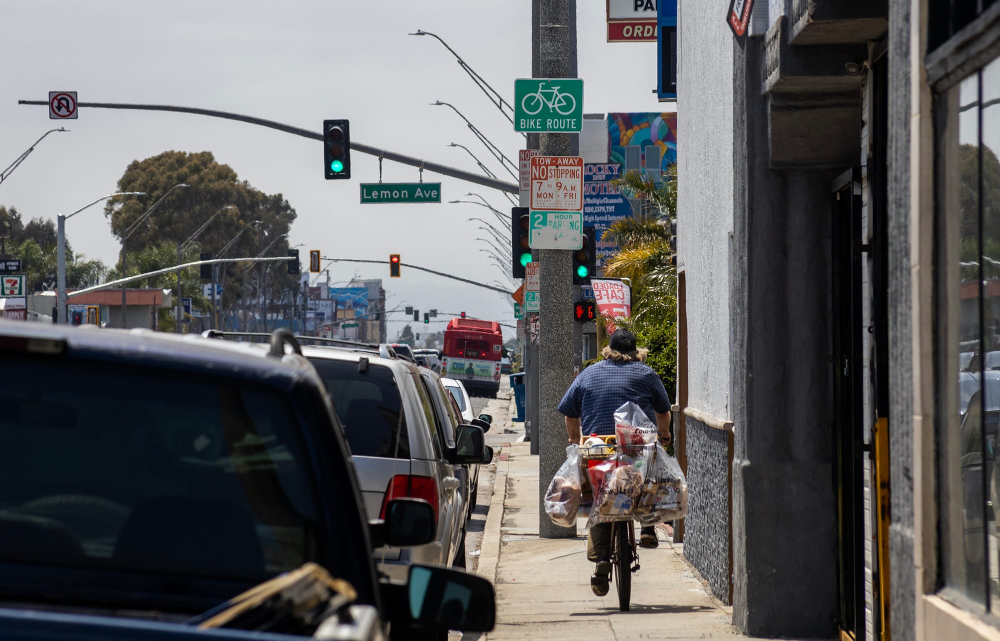
Despite having no safety infrastructure for bicyclists, PCH is a designated bike route and even features signage indicating that status. PCH also is one of the deadliest and most accident-prone corridors in the city, along with Anaheim Street, Pacific Avenue, Seventh Street and Long Beach Boulevard, according to data reviewed by NBC4.
“What this project aims to do is separate bicyclists and vehicles to ensure everyone can get to their destination safely,” Medina told city officials, adding that a 2024 survey with 2,200 responses showed the bike infrastructure would encourage a drastic uptick in pedestrian traffic.
“About 70% of respondents said that they would be more likely to bike and walk on PCH if some form of bicycle infrastructure was included,” Medina said. “We also had broader themes of pedestrian safety, pedestrian improvements as well as increasing lighting and putting in infrastructure that would help reduce vehicle speeds.”
Over the last decade, the city has put an emphasis on increasing bike routes throughout the city. Recent additions to the network include more than three miles of bike lanes along Artesia Boulevard in North Long Beach and forthcoming upgrades along Studebaker Road.
In addition to bike infrastructure, the city also has introduced road diets (Broadway) and reduced speed limits across Long Beach in its attempt to curb traffic-related deaths.
In 2001, the officials adopted a Bicycle Master Plan, which paved the way for 78 miles of bikeways to be added across the city through 2016. The additions brought the total bikeway mileage to 141, according to city documents.
The city adopted an updated Bicycle Master Plan in 2016, which set a goal of adding another 300 more miles of bikeways by 2040.
In 2020, the City Council adopted the Safe Streets Long Beach Action Plan, which included Vision Zero — a goal of reducing traffic-related fatalities and serious injuries to zero by 2026.
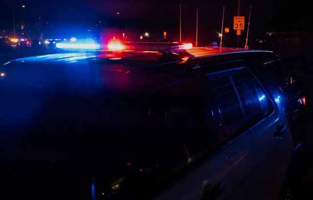
The number of traffic-related fatalities and serious injuries grew steadily from 113 in 2013 to 162 in 2017, according to city data. During that time, traffic-related fatalities averaged about 20 per year. Since then, that figure has ballooned.
In 2020, traffic-related fatalities topped out at 49, according to reports. In 2021 and 2022, the city reported 45 deaths, data shows. That figure dipped to 36 deaths in 2023 before jumping back up to 40 last year.
In 2025, however, Long Beach is on track to surpass 2020’s high. As of Oct. 27, Long Beach police have reported 47 traffic-related deaths.
"The City has made meaningful investments in infrastructure and staffing, but these improvements are just one piece of the larger picture of fatal and serious collisions," city spokesperson Jocelin Padilla-Razo said in an email Tuesday.
Padilla-Razo outlined the various city projects to improve corridors with new pedestrian crossings, protected bike lanes, updated signals and improved visibility for pedestrians. She also noted that Long Beach is one of six California cities to sign on to the Automated Speed Enforcement Program, which will use cameras to ticket speeders beginning sometime next year.
"These projects reflect the City's commitment to building safer, more accessible streets," Padilla-Razo said, adding that the city is "still aiming for Vision Zero and intends to complete the action items identified in the 2020 Safe Streets Plan in order to achieve the goal.
"We share the community’s concern about the rise in severe collisions and remain committed to advancing data-driven safety improvements across the city," Padilla-Razo continued. "Multiple factors contribute to serious and fatal traffic collisions, including driver behavior, impaired or distracted driving, and speeding, underscoring the need for ongoing collaboration and shared responsibility to make our streets safer for everyone."
Editor's note: This story has been updated with comments from the city of Long Beach as well as to include the timeline for Alternative 2.
We need your support.
Subcribe to the Watchdog today.
The Long Beach Watchdog is owned by journalists, and paid for by readers like you. If independent, local reporting like the story you just read is important to you, support our work by becoming a subscriber.